Northwest starts to feel the heat following un-snowy winter

The Pacific Northwest’s low snowpack has primed the region to turn dry and fire-prone earlier than usual.
Fire experts are bracing for a bad summer for wildfires around the western United States, a sneak peek of conditions in years ahead as the earth’s climate continues to warm.
“It's not set in stone, but with the combination of low snowpack and the spring and summer looking warmer and drier than normal, that's not a good mix for fire season,” deputy Washington state climatologist Karin Bumbaco said. “You have a longer opportunity for those fires to get started and to spread when the snowpack melts out sooner than normal.”
In most years, snowpack in Washington state builds to its annual peak in early April. In 2026, it peaked two weeks early, on March 17, according to Bumbaco.
On Tuesday, Washington’s snowpack was 51% of normal levels, according to the U.S. Natural Resources Conservation Service, with normal defined as the median value between 1991 and 2020.
Sponsored
Other states were in even worse shape.
In Oregon, snowpack was just 14% of normal. California’s was at 18%.
A high risk of fires could come to eastern Washington and eastern Oregon as early as June, according to federal officials with the National Interagency Fire Center in Boise.
That high fire hazard is expected to worsen and spread to southwestern Oregon in July.
An exceptionally warm winter was disastrous for many Northwest ski areas.
Sponsored
RELATED: From dry January to March madness: Seattle's worst ski season in years
The Northwest did not lack for precipitation, but too much of it fell as rain instead of snow for a plentiful snowpack to develop.
October through December 2025 was the warmest such three-month period on record in Washington, according to Bumbaco.
Globally, 2025 was the second- or third-warmest year on record, and the past 11 years were the 11 warmest on record, according to the World Meteorological Organization.
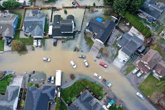
The impacts of paltry mountain snow are starting to be felt in Pacific Northwest lowlands.
Sponsored
The Army Corps of Engineers has been raising the level of Seattle’s Lake Washington and Lake Union, something the Corps does every spring.
RELATED: Major snow dump buoys Northwest skiers, can’t undo snow drought
But this year’s low snowpack in the Cascades has led officials to fill the lakes up to their full levels earlier than usual.
The Army Corps wants to make sure there’s enough water for summer navigation by boats and by salmon moving through the lakes and the Ballard Locks.
The Corps has been warning boat and shoreline property owners to be ready for the lakes to rise up to two feet in April.
Sponsored
“It's a significant difference for people in house boats, for example, because they're coming on and off their boat at different elevations to a land that's at the same elevation,” Army Corps senior water manager Kyle Comanor said.
The lakes’ water levels, which fluctuate between 20 feet and 22 feet above sea level, are controlled by operation of the Ballard Locks, near Puget Sound.
Comanor said water managers can conserve the lakes’ water by restricting the movement of boats through the locks.
“ It's not something that we ever want to do,” he said.
Snowpack in the central Washington Cascades — including the headwaters of the Cedar River, which flows into Lake Washington — was at 47% of normal on Monday, according to the Natural Resources Conservation Service.
Sponsored
Managers of Seattle’s water supply also refilled reservoirs on the Tolt and Cedar rivers early to maximize water storage.
“We plan to hold reservoir storage near maximum levels through the next two months and into June as long as we can,” Seattle Public Utilities spokesperson Nicole Elliott said by email. “This will help prepare us for the dry summer months when water usage is the highest.”
East of the Cascades, water managers are expecting a difficult summer as well. Snowpack in the upper Yakima basin was at 32% of normal on Monday.
Irrigators are expecting to have to turn off the spigots entirely in late summer.
“There will be significant impacts,” Scott Revell with the Roza Irrigation District in the Yakima Valley said by text message. “We are planning to shut off completely for at least two weeks.”
Roza Irrigation District farmers grow $1.3 billion in crops annually, mostly high-value items like apples, cherries, hops, and grapes, with melting mountain snow as their primary water supply.
The Yakima basin is going into its fourth consecutive drought year.
Many Roza farms fallowed one-fourth of their irrigated acreage in 2025, according to Revell, leaving them either unwatered or watering them just enough to keep plants alive for next year.
Revell said he expects irrigation season will have to end around Sept. 30, three weeks early.
“Not good for late-season crops like wine grapes, hops, and later apples,” he said.
With most of the American West suffering from snow drought, impacts on economies and even breathing could be wide-ranging.
Smoke from other states’ fires has a good chance of darkening Northwest skies, and vice-versa.
Atmospheric scientists expect El Niño conditions — which typically bring unusually warm temperatures to the Pacific Northwest — to return by mid-summer, with the possibility of strong El Niño conditions arriving by September.
-
John Ryan

Environment Reporter
John Ryan joined KUOW as its first full-time investigative reporter in 2009 and became its environment reporter in 2018. He focuses on climate change, energy, and the ecosystems of the Puget Sound region.
More stories from John Ryan »