How is Washington's snowpack looking this spring?
Climatologists look to snowpack recordings made on April 1 as an indicator of possible drought conditions on the West Coast.
This year, snowpack levels in California were dramatic — 237% of average statewide. In fact, California tied a record from 1952.
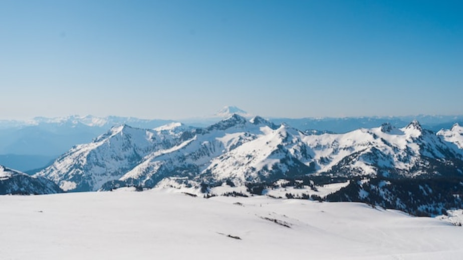
In Washington state, the snowpack is currently just above normal, at 104%.
Karin Bumbaco is Washington state's assistant climatologist. She said forecasters were hopeful for a good snowpack during this La Niña year, when winter temperatures are generally cooler than normal in the North, but she's seen some surprises.
"If you actually look at precipitation, we've been below normal," Bumbaco said. "So thinking back to last summer, where we were really dry; we were dry starting the year out in the fall, saw some good precipitation in late fall. But then again, since January 1, we've been on the dry side. So we've had below-normal precipitation, but because our temperatures have been so cold, we've been able to build snowpack in the mountains."
Sponsored
Bumbaco said there are variations in levels around the state. The west slopes of the Cascades in Whatcom County are averaging 75%–85% of normal. But the Blue Mountains in southeast Washington are around 120% of average.
Bumbaco's statements echo an assessment from Washington's Department of Ecology. The La Niña that ended in March was expected to bring colder and wetter conditions. It only brought colder temps, however, and the rain didn't show up as much as expected. This is why, according to Ecology, "Lurking beneath the snowpack are soil-moisture deficits resulting from a dry spring and summer." The fact that the Eastern United States got much of the Pacific Northwest's rain in late 2022 could explain some of this.
Monitoring snowpack levels is important for state officials and residents. The levels indicate how much water is being stored (as ice) in the mountains going into the drier summer months.
Bumbaco notes that the last two springs have really been unusual in the Pacific Northwest. April through June of 2022 was wetter and colder than normal. The same period in 2021 was almost the exact opposite, with record warm and dry conditions resulting in drought later in the season. She says that people in her field tend to focus on April 1 when it comes to rain and snowpack, but they're learning that Northwest springs can also highly influence conditions in the months ahead.
"The last two seasons have been a good reminder that spring can really change the drought outlook. So we are going to continue to monitor conditions going forward."
Sponsored
KUOW's Dyer Oxley contributed to this story.
-
John O'Brien

Senior Producer, All Things Considered
John O’Brien is KUOW's All Things Considered Senior Producer. He spends his days setting up interviews with newsmakers on subjects from politics and public health to arts and culture. John learned to make radio starting in 2006 as an intern on KUOW’s The Conversation with Ross Reynolds.
More stories from John O'Brien »


